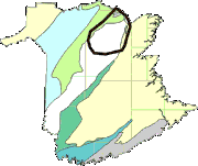
The Bathurst Mining Camp (BMC) occupies a roughly circular area of approximately 70 km diameter in the Miramichi Highlands of northern New Brunswick. The area boasts some 46 mineral deposits with defined tonnage and another hundred mineral occurrences, all hosted by Cambro-Ordovician rocks that were deposited in an ensialic back-arc basin.
The Bathurst Mining Camp (BMC) virtual field trip contains the following:
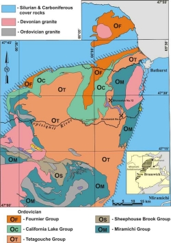
- Maps showing the surface distribution of the groups and formations that comprise the BMC
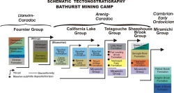
- Schematic stratigraphic columns of the rock groups
- Digital photos of the rock units* from type-sections and other significant exposures
- Links to the New Brunswick Stratigraphic Lexicon and to digital Fieldtrip Guidebooks (see links to PDF files below);
- A listing of Fieldtrip Stops that pertain to corresponding rock formations/units.
All graphic- and photo-images may be downloaded and used freely. Questions regarding this virtual field trip or the Bathurst Mining Camp should be directed to [email protected].
*Photo-image descriptions include the NTS Map Sheet and geographic coordinates (NAD83) of each image’s location.


