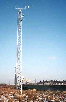
Road weather information systems (RWIS) provide detailed roadside weather conditions and road surface temperature data. A complete RWIS combines the roadside readings with standard meteorological data to provide precision road weather forecasts and pavement condition predictions.
Forty-one environmental sensor stations (ESS) operate on the province’s highways as part of the provincial Road Weather Information System. The highway cameras on these stations are available online for the information of the travelling public.
The most visible RWIS component is the roadside ESS. The typical ESS installation includes a short tower, mounting an array of meteorological sensors coupled with a selection of road surface sensors. Processors collect and analyze sensor data transmitting the information to a CPU or server.
The CPU compiles data from all remote sites to provide road managers with a picture of actual weather and road conditions on an entire highway network. Forecasting services then combine collected site information with Environment Canada weather data to predict road temperature and conditions for up to 12 hours.
