Tim Lavoie
Fossil Hill (Cu)
Commodity: Copper, base metals
Claim block number (units): 9464, 10810, 10812, 10813, 10829, 10830 (62)
NTS Location: 21 O/09
Contact Information: 506-790-4706
[email protected]

Commodity: Copper, base metals
Claim block number (units): 9464, 10810, 10812, 10813, 10829, 10830 (62)
NTS Location: 21 O/09
Contact Information: 506-790-4706
[email protected]

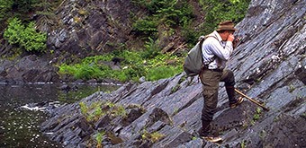
The Fossil Hill project is located within the Bathurst Mining Camp, 6 km north of the Caribou Mine.
Log House Construction Ltd. carried out an electromagnetic and VLF survey in the area and reported analyses of bedrock up to 13.84% and 16.65% Cu. Additionally, Log House Construction Ltd. has reported soil test samples up to 5.3% Cu. (Report of work 477173).
In the summer of 2023, Prospect Or (Tim Lavoie) discovered 2 new copper zones with chalcopyrite and chalcocite mineralization with values of 3.6%, 1.61%, and 1.52% Cu. These results are from outcrops inside a trench. A study/compilation of work made it possible to delineate copper in the rocks and soil over more than 500 m in width and 1000 m in length. The Fossil Hill showing lies east of the Boudreau Brook Copper showing. Both projects are held by the same mineral claim holder.
Mineralization consists of native copper occurring in tiny fractures and as disseminations in middle- Ordovician basalt. Immediately to the north, the basalts are overlain by unmineralized Silurian carbonate and clastic sedimentary rocks. However further north, Carboniferous clastic sedimentary rocks are disconformable on the Silurian sequence. It is likely that these Carboniferous rocks were, at one time, unconformable on the basalts hosting the native Cu but were subsequently eroded. It is postulated that the native Cu mineralization is related to oxidation-reduction reactions typical in sediment hosted Cu deposits, such as those hosted by Carboniferous rocks in southern New Brunswick.